Archives
-
Recent Posts
Fellow SUS09'ers
Happy Links
Monthly Archives: May 2009
Fun with Elevation Profiles
No ride today, I spent the day downtown getting my First Aid and CPR certification and this evening playing around with Delorme Topo USA, the software we will be using to help us route the trip this summer. Topo is kinda cool in that it uses info from the USGS for route statistics like distance, elevation, etc but it also kinda sucks in that it’s one of the most difficult pieces of software to pick up and use. And that’s saying a lot coming from a guy that was forced to use both Patran and Abaqus…. It appears that you can get some super accurate data from Topo though, which makes it enticing.
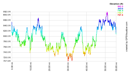
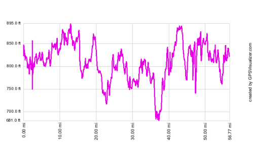
I thought that this was a great opportunity to check the elevation tracks my phone has been giving me on my rides this week as they seem to have been a bit odd. Below is a comparison of the elevation track from my phone on the one from Topo.
Phone:
Don’t get me wrong, they are different, but they are much closer than I thought they would be. Sweet. The phone also appears to consistantly record everything as 50 lower than it actually is.
Check Your Cue Sheets!
Today was supposed to be a ride in the 40-45 mile range. I wanted to take my time, drop in on some family, and take it easy. Instead the ride ended up being 52-ish miles with a hellish wind out of the East, the wind made the ride turn from slow and relaxing to slightly grueling and tiring. The extra milage is due to 1) missing road signs out in the middle of farm country and 2) me not checking to make sure that the cue sheets I generated use mapmyride.com were correct. Mapmyride has a horrible habit of totally sucking at everything it says it does. Unfortunately they are the best site out there right now, and free. Anyone use/know of anything better to use to route and cue up a ride?
Hebron and back
Headed out with Andrew this morning, good ride. Sunny, 70-ish. Longest ride of the season, 56 miles or so, average speed around 17 mph.
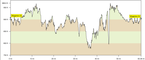
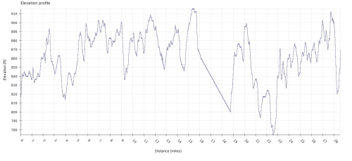
Still trying to find the right elevation visualization tool… It appears that my start and end elevations are within a tolerable range this ride, that’s good.
Trying to find Marc & Kat and Anne & Andrew’s houses
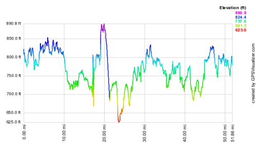
Brief ride today. Headed west a bit and then tried to keep it mostly North-South. The wind out of the East was a big one today.
Again note that my starting location rose as I was riding. That funny straight line is a result of losing the GPS lock for a bit.
Suburban Riding
It isn’t quite the wide open road of Central Illinois, but it’s nice to have some hills. Met up with Dave to ride this afternoon, it’s exponentially better riding with a partner.
I’ve attached an elevation profile of the ride, it’s particularly interesting because we began and ended at the same place….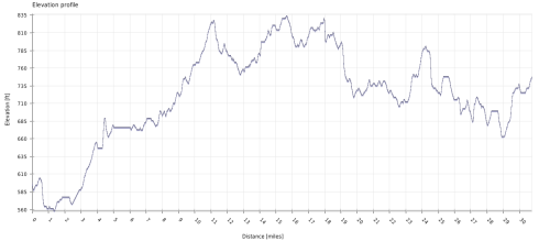
Quick Ride
Rode in a general Westerly direction today, the wind was FIERCE out of the South. I was aiming for the small town of Deers but missed it by one country block.
Stupid phone never managed to grab ahold of a satellite so no map for today. I think I went about 25 miles, not so sure.
Sadorus, where are you?
Sardorus loop (kinda) backwards today. Took some pictures around mile 22. Pretty sweet that my summer is going to consist of doing exactly this day after day. Very happy with the new camera, the colors are great.
Oh yes, this is what riding is like.
Bam, I’m on a roll. I call this route the “Signs with Bullet Holes Loop.” Down where I turned back North onto 1500e there were 6 signs with bullet holes through them. That is so American, it made me proud. Nothing says “I love my guns” betten that going around and shooting shit from my car, while drinking Busch Light, in overalls. /sarcasm
The accuracy of the GPS pissed me off today.
Hello, Bike, I’m Will. Remember me?
Old faithful Tolono Loop.
I never realized how perfectly geometric my rides around here were….

